Government
Resources
—Planning—
Author:
La Crosse Building Trades
Description:
Concept approval La Crosse Common Council, La Crosse County Board. Shows a proposal for the Bicentennial Expressway including key businesses. No scale given.
Map / on sheet 90 x 59 cm. / Black and white
Map / on sheet 90 x 59 cm. / Black and white
Author:
Wisconsin Department of Natural Resources
Creator:
Wisconsin. Department of Natural Resources.
Description:
A two page, tri-fold brochure describing the successful partnership between the City of La Crosse and Century Telephone (CenturyTel) to create the Riverside Redevelopment Project. Funding sources included brownfield grants from the US Department of Commerce, the Department of Natural Resources and the City of La Crosse. Construction on the building began in the fall of 1999.
Author:
University of Wisconsin-La Crosse
Creator:
Braun, Cody
Hawkins, Chandra
Nimtz, Frederick
Kullerud, Erik
Hawkins, Chandra
Nimtz, Frederick
Kullerud, Erik
Description:
Four years ago, the City of La Crosse, Wisconsin was awarded Silver Status as a bicycle friendly community by the League of American Bicyclists. As the renewal date of the status approaches, community leaders are concerned that new League guidelines combined with the lack of sufficient change in bicycle accommodations that have occurred in the past four years will result in the city either being downgraded, receiving Honorable Mention Status, or failing to be awarded any status at all. Focusing on the League of American Bicyclists’ five essential elements of engineering, education, encouragement, enforcement, and evaluation/planning, a plan was put before the local steering committee. Considerations included ties between the health benefits of bicycling, Safe Routes to School, the economic benefits of walkable and bicycle friendly retail areas, and the economic benefits businesses enjoy from having bicycle friendly policies for their employees. Following that meeting, plans to identify a police liaison, create a community resources website template for the city, and make strategic business connections were developed and executed.
Published as part of the University of Wisconsin-La Crosse Journal of Undergraduate Research, Volume 18 (2015)
Published as part of the University of Wisconsin-La Crosse Journal of Undergraduate Research, Volume 18 (2015)
Author:
John Nolen
Description:
This map was part of a 1911 report by John Nolen (Making of a park system in La Crosse) on the creation of La Crosse’s park system. The map shows suggested parks and parkways in green. Scale 1:31,680; 1 inch = 1/2 mile
Map / 46 x 31 cm on sheet 53 x 38 cm / Color
Map / 46 x 31 cm on sheet 53 x 38 cm / Color
Author:
La Crosse Public Library
Creator:
La Crosse Tribune
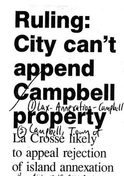
Description:
A collection of newspaper articles about annexation.
History of the Issue:
The Town of Campbell was created at the time La Crosse County was organized in 1851. Campbell lost land mass when dams were constructed on the Mississippi River in the 1930s. By 1954, the Town of Campbell had been split in two by the southern growth of the city of Onalaska and the northern growth of the city of La Crosse. As a result, the town of Medary was formed west of Oak St., leaving the borders of the Town of Campbell largely to French Island and its environs.
About These Materials This grouping of articles highlights the ongoing discussion between the Town of Campbell and the City of La Crosse regarding annexation, boundaries, efforts to cooperate, and public services such as water. Since 1983, the city has tried to actively encourage Campbell residents to annex to the city. A court decision in 2002 over annexation led to a split: the city of La Crosse gained some properties on Hiawatha Island, a small island east of French Island, while ruling that annexation into French Island itself was invalid. Also, several moves to incorporate as a village began as early as 1966, with the most recent effort as late as 2002.
About These Materials This grouping of articles highlights the ongoing discussion between the Town of Campbell and the City of La Crosse regarding annexation, boundaries, efforts to cooperate, and public services such as water. Since 1983, the city has tried to actively encourage Campbell residents to annex to the city. A court decision in 2002 over annexation led to a split: the city of La Crosse gained some properties on Hiawatha Island, a small island east of French Island, while ruling that annexation into French Island itself was invalid. Also, several moves to incorporate as a village began as early as 1966, with the most recent effort as late as 2002.
Author:
City of La Crosse Planning Department (La Crosse, Wis.)
Creator:
La Crosse (Wis.). City Planning Department
Description:
The City's comprehensive plan for Hixon Forest approved by the La Crosse City Council in 2005.
Author:
The Dept.
Creator:
La Crosse (Wis.). City Planning Department
Description:
Hixon Forest is an 800-acre nature-based park on the eastern edge of the city of La Crosse, Wisconsin. In 2003, the City's Planning Department initiated a project to develop a comprehensive plan for Hixon Forest. The park is maintained and is within the jurisdiction of the city's Park, Recreation and Forestry Department. Stemming from a survey of the forest plants in Hixon Forest, it was decided that a policy needed to be put into place to guide the City Park, Recreation and Forestry Department in its management of this entity. This work is the comprehensive plan that resulted from that study.
ii, 47 p.
col. maps ; 28 cm
"Adopted May, 2005"
Cover title
ii, 47 p.
col. maps ; 28 cm
"Adopted May, 2005"
Cover title
Creator:
William D. Klaus
Description:
The study investigates the impact of Harborview Plaza, which is the urban renewal project of the La Crosse river front area. This paper includes a short history of the events that led to the deterioration of the area. Some of the questions examined are: what effect will the project have on the established businesses in the C.B.D., do businessmen view it as beneficial or as a threat to their existence, is it beneficial for the public, and what is the public reaction to Harborview. Much of the information for this study was obtained by personal interviews with the city engineer, city planner, and the La Crosse Redevelopment Authority. A search of the available literature was made. This was basically the La Crosse Tribune, reports by the city planner, and other studies made by different departments of the city that affect the water front area. To get the viewpoint of the city businesses, a questionnaire was distributed among downtown businessmen. A citizen survey was used to find out how Harborview was seen by the public and what the public expects from it. The results of the study are as follows: 1) La Crosse has already realized an increased tax base by the relocation of businesses to other areas of the city, 2) it is a general consensus that most businessmen are in favor of Harborview Plaza even if it poses certain problems, and 3) the public is in favor of the plaza.
UWL seminar paper
UWL seminar paper
Author:
John Nolen
Description:
One in a series of maps created by John Nolen, landscape architect and urban planner. Proposed streets shown in red. Plan number 46. Planned features include allotment garden, belt line, aviation field on Isle La Plume, boat basin, union station, state fair grounds, passenger car yards, La Crosse River canal, Myrick Park Recreation Field, industrial district. Map shows existing and proposed streets, street car lines, parks and playgrounds, school grounds, public and semi-public areas, cemeteries, railroads, railroad stations, hospitals, fire stations, court house, post office, library, county jail, Inter State Fair Grounds, La Crosse Country Club, pumping station, Wells Water Works. Scale 1:9600; 1 inch = 800 feet
Map / Manuscript / 98 x 65 cm. on sheet 115 x 85 cm.
Map / Manuscript / 98 x 65 cm. on sheet 115 x 85 cm.
Author:
John Nolen
Description:
One in a series of maps created by John Nolen, landscape architect and urban planner. Population figures for each ward shown in red. Plan number 32. Map shows existing and proposed streets, street car lines, parks and playgrounds, school grounds, public and semi public areas, cemeteries, railroads, railroad stations, hospitals, fire stations, court house, post office, library, county jail, Inter State Fair Grounds, La Crosse Country Club, pumping station, Wells Water Works. Scale 1:9600; 1 inch = 800 feet.
Scale 1:9600; 1 inch = 800 feet
Scale 1:9600; 1 inch = 800 feet
Author:
John Nolen
Description:
One in a series of maps created by John Nolen, landscape architect and urban planner. Proposed residential, retail business, wholesale business, and industrial properties shown in color. Plan number 34. Map shows existing and proposed streets, street car lines, parks and playgrounds, school grounds, public and semi public areas, cemeteries, railroads, railroad stations, hospitals, fire stations, court house, post office, library, county jail, Inter State Fair Grounds, La Crosse Country Club, pumping station, Wells Water Works. Scale 1:9600; 1 inch = 800 feet
Map / Manuscript / 98 x 65 cm. on sheet 115 x 85 cm.
Map / Manuscript / 98 x 65 cm. on sheet 115 x 85 cm.
Author:
John Nolen
Description:
One in a series of maps created by John Nolen, landscape architect and urban planner. Plan number 30. Map shows existing and proposed streets, street car lines, parks and playgrounds, school grounds, public and semi public areas, cemeteries, railroads, hospitals, fire stations, court house, post office, library, county jail, Inter State Fair Grounds, La Crosse Country Club, pumping station, Wells Water Works. Scale 1:9600; 1 inch = 800 feet
Map / Manuscript / 98 x 65 cm. on sheet 115 x 85 cm.
Map / Manuscript / 98 x 65 cm. on sheet 115 x 85 cm.
Author:
John Nolen
Description:
One in a series of maps created by John Nolen, landscape architect and urban planner. Plan number 49. Dollar valuations per acre are shown in red for the Wisconsin counties of Buffalo, Trempealeau, Jackson, Monroe, La Crosse, Vernon and Crawford, the Minnesota counties of Winona, Houston, and Fillmore and the Iowa counties of Winneshiek and Allamakee. Scale 1:190080; 1 inch = 3 miles
Map / Manuscript / 98 x 65 cm. on sheet 115 x 85 cm.
Map / Manuscript / 98 x 65 cm. on sheet 115 x 85 cm.
Author:
John Nolen
Description:
One in a series of maps created by John Nolen, landscape architect and urban planner. Plan number 48. Populations (county and town) are shown in red for the Wisconsin counties of Buffalo, Trempealeau, Jackson, Monroe, La Crosse, Vernon and Crawford, the Minnesota counties of Winona, Houston, and Fillmore and the Iowa counties of Winneshiek and Allamakee. Scale 1:190080; 1 inch = 3 miles
Map / Manuscript / 98 x 65 cm. on sheet 115 x 85 cm.
Map / Manuscript / 98 x 65 cm. on sheet 115 x 85 cm.
Author:
John Nolen
Description:
One in a series of maps created by John Nolen, landscape architect and urban planner. Proposed and existing buildings shown for the central part of the city. Plan number 25. Map shows Episcopal Church, museum and art gallery, library, Masonic Temple, New school, Burns Park, Congregational Church, YMCA, State Armory, Community Building, War Memorial, Longfellow School, future site of City Hall, Liberty Square, St. Joseph Church, Parochial School, Post Office, Central Fire Station, County Court House, Cameron Park
Scale 1:2400; 1 inch = 200 feet
Map / Manuscript / 45 x 29 cm on sheet 54 x 38 cm / C
Map / Manuscript / 45 x 29 cm on sheet 54 x 38 cm / C
Author:
John Nolen
Description:
One in a series of maps created by John Nolen, landscape architect and urban planner. Water sewer and street car lines shown in blue, yellow and red. Sewer outfalls into Mississippi River also shown. Plan number 33. Map shows existing and proposed streets, street car lines, parks and playgrounds, school grounds, public and semi public areas, cemeteries, railroads, railroad stations, hospitals, fire stations, court house, post office, library, county jail, Inter State Fair Grounds, La Crosse Country Club, pumping station, Wells Water Works
Scale 1:9600; 1 inch = 800 feet
Map / Manuscript / 98 x 65 cm. on sheet 115 x 85 cm.
Map / Manuscript / 98 x 65 cm. on sheet 115 x 85 cm.
Author:
John Nolen
Description:
One in a series of maps created by John Nolen, landscape architect and urban planner. Plan number 31. Valuations shown in red. Scale 1:9600; 1 inch = 800 feet. Map shows existing and proposed streets, street car lines, parks and playgrounds, school grounds, public and semi public areas, cemeteries, railroads, railroad stations, hospitals, fire stations, court house, post office, library, county jail, Inter State Fair Grounds, La Crosse Country Club, pumping station, Wells Water Works.
Map / Manuscript / 98 x 65 cm. on sheet 115 x 85 cm.
Map / Manuscript / 98 x 65 cm. on sheet 115 x 85 cm.
Author:
John Nolen
Description:
One in a series of maps created by John Nolen, landscape architect and urban planner. Proposed features include allotment gardens, belt line, aviation field on Isle La Plume, municipal docks, boat basin, state fair grounds, union station, municipal docks, passenger car yards, La Crosse River canal, industrial district, community centers, civic center at Main and 7th streets, museum and art gallery at Main and 8th streets, park lined streets throughout the city, Black River Drive, Victory Street, Levee Drive. Plan number 45. Map shows existing and proposed streets, street car lines, parks and playgrounds, school grounds, public and semi public areas, cemeteries, railroads, railroad stations, hospitals, fire stations, court house, post office, library, county jail, Inter State Fair Grounds, La Crosse Country Club, pumping station, Wells Water Works. Scale 1:9600; 1 inch = 800 feet
Map / Manuscript / 98 x 65 cm. on sheet 115 x 85 cm.
Map / Manuscript / 98 x 65 cm. on sheet 115 x 85 cm.
Author:
City of La Crosse
Creator:
City of La Crosse
Description:
forms part of the La Crosse River Valley Study
"As prepared and approved by: City of La Crosse, La Crosse County, Wisconsin Department of Transportation, Wisconsin Department of Natural Resources"
ocm55117469
ocm55117469
Author:
J. Nolen
Creator:
Nolen, John, 1869-1937
La Crosse War Memorial Commission (La Crosse, Wis.)
La Crosse War Memorial Commission (La Crosse, Wis.)
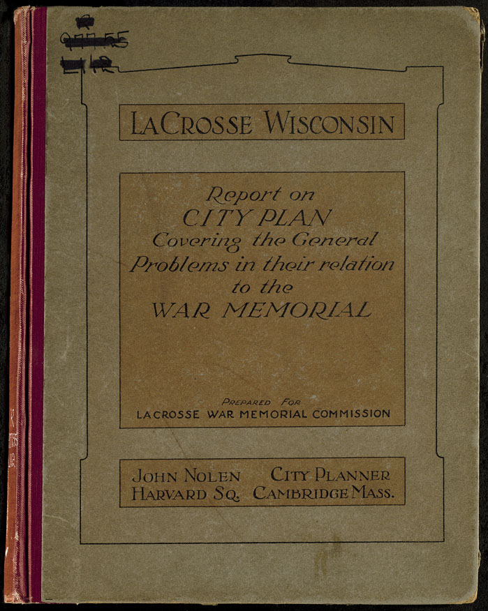
Description:
The first comprehensive city plan for La Crosse is this effort by John Nolen, noted landscape architect and city planner. Nolen is credited with forming the city park system in La Crosse and was hired by the La Crosse War Memorial Commission to do this plan. In part, it was intended to honor veterans of the Great War, or more commonly known now as World War I. This report accompanies a set of maps by Nolen which are also digitized.
At head of title: La Crosse, Wisconsin. "Prepared for La Crosse War Memorial Commission"--Cover
106 leaves, [11] leaves of plates : ill. (some col.) ; 29 cm.
At head of title: La Crosse, Wisconsin. "Prepared for La Crosse War Memorial Commission"--Cover
106 leaves, [11] leaves of plates : ill. (some col.) ; 29 cm.
Author:
Alvord, Burdick & Howson
Description:
a plan to fill the La Crosse River marsh submitted to the City Planning Commission, City of La Crosse
ocm15738142
ocm15738142
Author:
Upper Mississippi River Basin Coordinating Committee
Creator:
Upper Mississippi River Basin Coordinating Committee
Description:
Appendix A: History of Investigation (vol. II) documents the state and federal organizational arrangements and planning procedures used in this basin study to obtain overall integrated plans for the development, control and use of water and related land resources. The Department of the Army, Corps of Engineers was then given responsibility for providing leadership for the study.
Item donated by the Upper Mississippi River Conservation Committee (UMRCC) to Murphy Library in 2018. Part of the UMRCC Collection housed at Murphy Library, University of Wisconsin-La Crosse.
Item donated by the Upper Mississippi River Conservation Committee (UMRCC) to Murphy Library in 2018. Part of the UMRCC Collection housed at Murphy Library, University of Wisconsin-La Crosse.
Author:
Upper Mississippi River Basin Coordinating Committee
Creator:
Upper Mississippi River Basin Coordinating Committee
Description:
Appendix Q: Framework for Development (vol. IX)
Item donated by the Upper Mississippi River Conservation Committee (UMRCC) to Murphy Library in 2018. Part of the UMRCC Collection housed at Murphy Library, University of Wisconsin-La Crosse.
Item donated by the Upper Mississippi River Conservation Committee (UMRCC) to Murphy Library in 2018. Part of the UMRCC Collection housed at Murphy Library, University of Wisconsin-La Crosse.
Author:
Upper Mississippi River Basin Coordinating Committee
Creator:
Upper Mississippi River Basin Coordinating Committee
Description:
Main Report: summarizes the findings of the 17 supporting appendices.
Item donated by the Upper Mississippi River Conservation Committee (UMRCC) to Murphy Library in 2018. Part of the UMRCC Collection housed at Murphy Library, University of Wisconsin-La Crosse.
Item donated by the Upper Mississippi River Conservation Committee (UMRCC) to Murphy Library in 2018. Part of the UMRCC Collection housed at Murphy Library, University of Wisconsin-La Crosse.